SatGazer version 2.1 released
Frederik Mrozek, DL6FM, has released version 2.1 of SatGazer – a MacOS satellite tracking software.
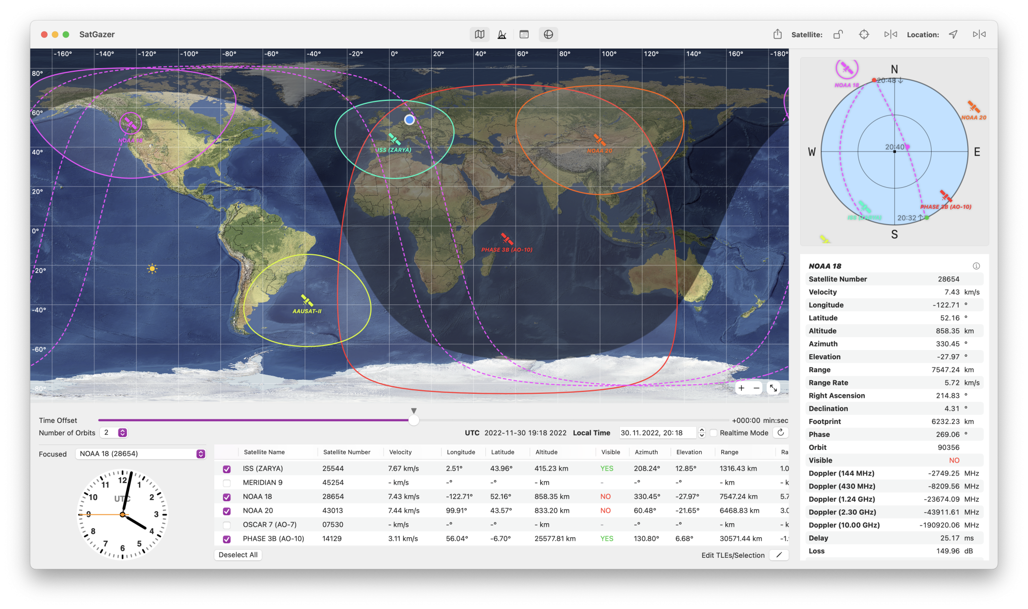
SatGazer is a software that provides rich visualizations for the positions of satellites in different ways on a map with footprint and predictions. Download a collection of TLEs (orbit data) via the downloader in the app and select the satellites you are interested in. SatGazer then displays the selected satellites on a map and shows the trail for the focused satellite. It also displays the footprint for the satellites. If you want to observe or receive satellites – for example receive weather data from NOAA satellites -, SatGazer offers different ways to plan your observation. You can also export future passes of satellites as a formatted text document.
Platforms
SatGazer is available for macOS 12.0 (Monterey) or later
Details
Every satellite has an individual color, that is calculated with the satellite ID, so it is consistent in all views and stays the same at every startup of SatGazer.
Changes in version 2.1
- Create collections for satellites
- Warning for old TLEs
- Minor improvements
SatGazer is available now on the Apple Mac App store for $1.99
You can find more information about the app on the DL6FM Software website

